Archives For ADK 46-R

Finishing the Dix

July 15, 2016 — Leave a comment

FullSizeRender 8

I have hiked in the Dix Mountain Wilderness twice before but managed to climb only three of the five high peaks located there.

On the first trip the plan had been to climb all five, starting at Grace and ending at Dix. Our group was overconfident and underprepared and we turned back after reaching Grace too late in the day to try for the others.

Last fall, I backpacked over Dix Mountain but could not find the herd path leading from the Beck-horn to Hough Peak and South Dix. The next day we climbed Macomb but decided not to push on to South Dix and Hough.

Today, my nephew Josh and I reached the two peaks I had left behind twice before.

We began our hike from the Elk Lake trail head at 7:00 AM. We reached the herd path that follows the Lillian Brook at 8:21 and found the trail to the summit to be in very good condition making for an easy climb. We reached Hough Peak at 10:30, backtracked to South Dix and finished the hike at 2:30 PM.

These two bring my total to 28.

IMG_3756

Several months ago my nephew Josh texted me to ask whether he could spend his vacation hiking in the Adirondacks. We agreed on a date and convinced my nephew Alex to bring some friends and join us.

Josh and I arrived on Saturday and our plan was to wake early Sunday and climb the three peaks that make up the Seward Mountain Range. The weather report indicated that there was a small chance of rain and we thought that at worst it would rain in the morning before clearing later in the day.

FullSizeRender 3

We left Lake Placid at 6:00 AM and started the hike at 7:00, but at the wrong trail head. We recognized the mistake after about a mile and turned back, found the right parking lot and started for Mount Donaldson at 8:00 AM.

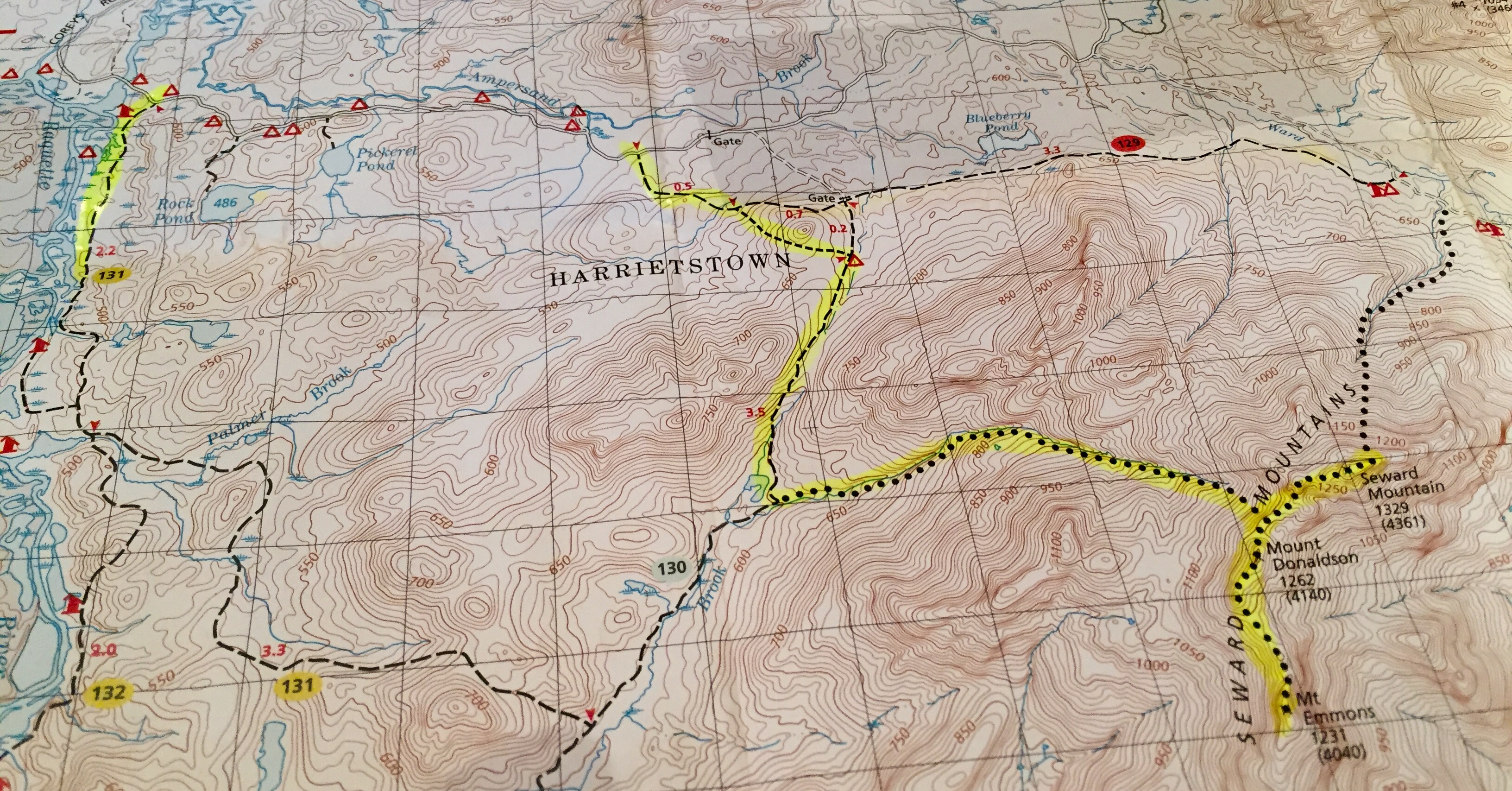
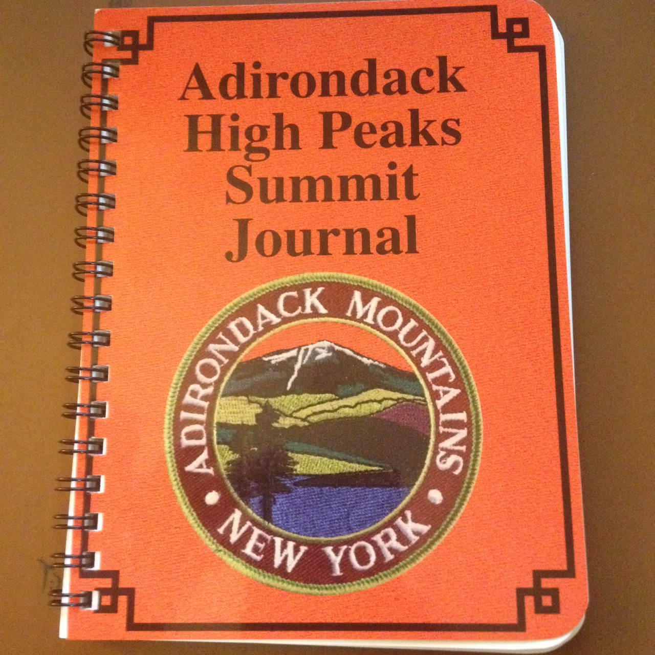
There are three mountains in the range. The northern most is named for William Henry Seward, Abraham Lincoln’s Secretary of State. The middle mountain is named for Alfred Lee Donaldson who wrote a history of the Adirondacks and the southern peak is named for Ebenezer Emmons who, while serving as the state geologist, was part of the expedition that made the first ascent of Mt Marcy in 1837.

We reached the herd path to Donaldson at about 10 and reached the top of Donaldson at 12:30. We spent the next two hours hiking to the summits of Mt. Emmons and Seward Mountain before returning Donaldson and backtracking to the trailhead.

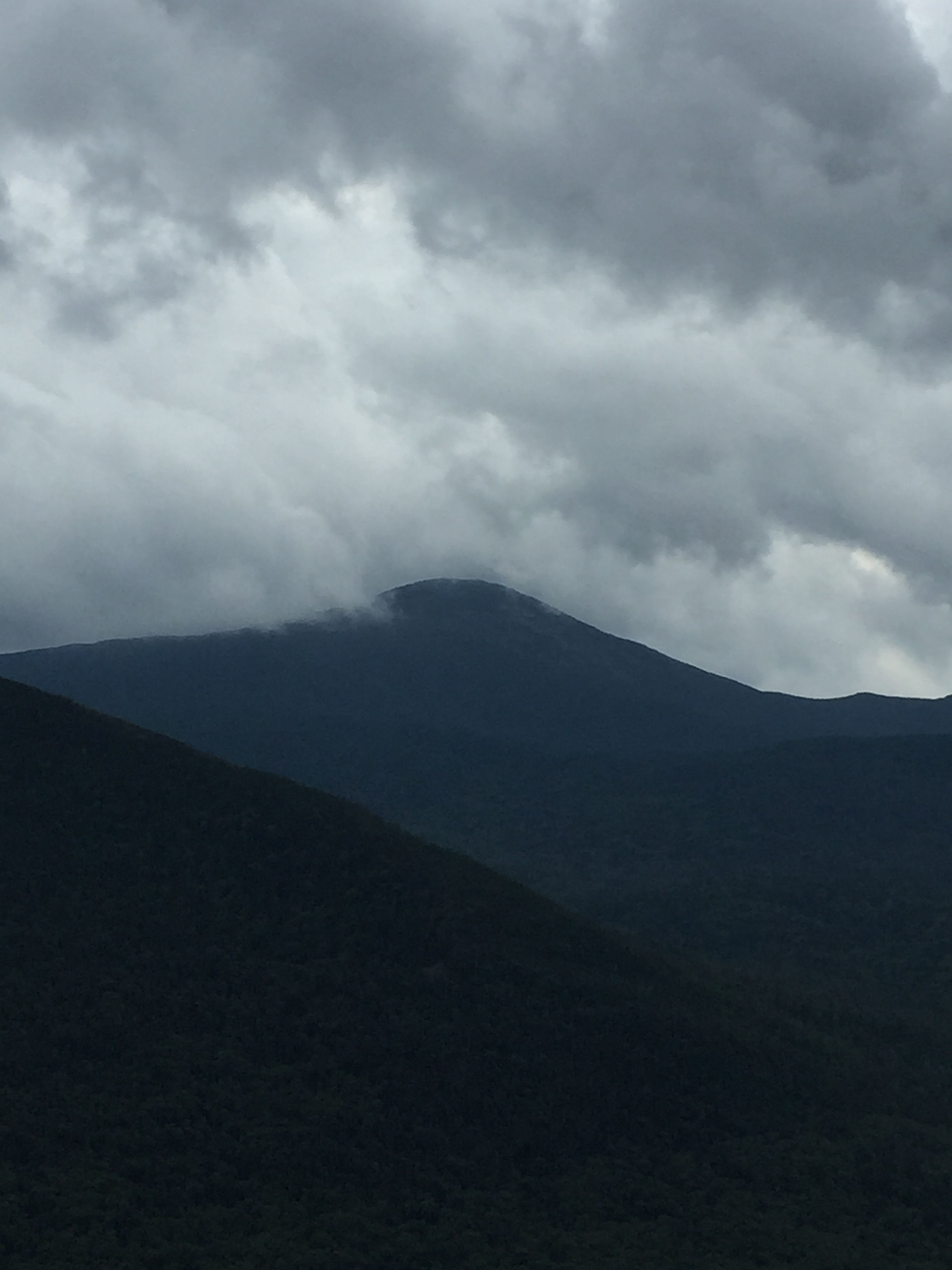
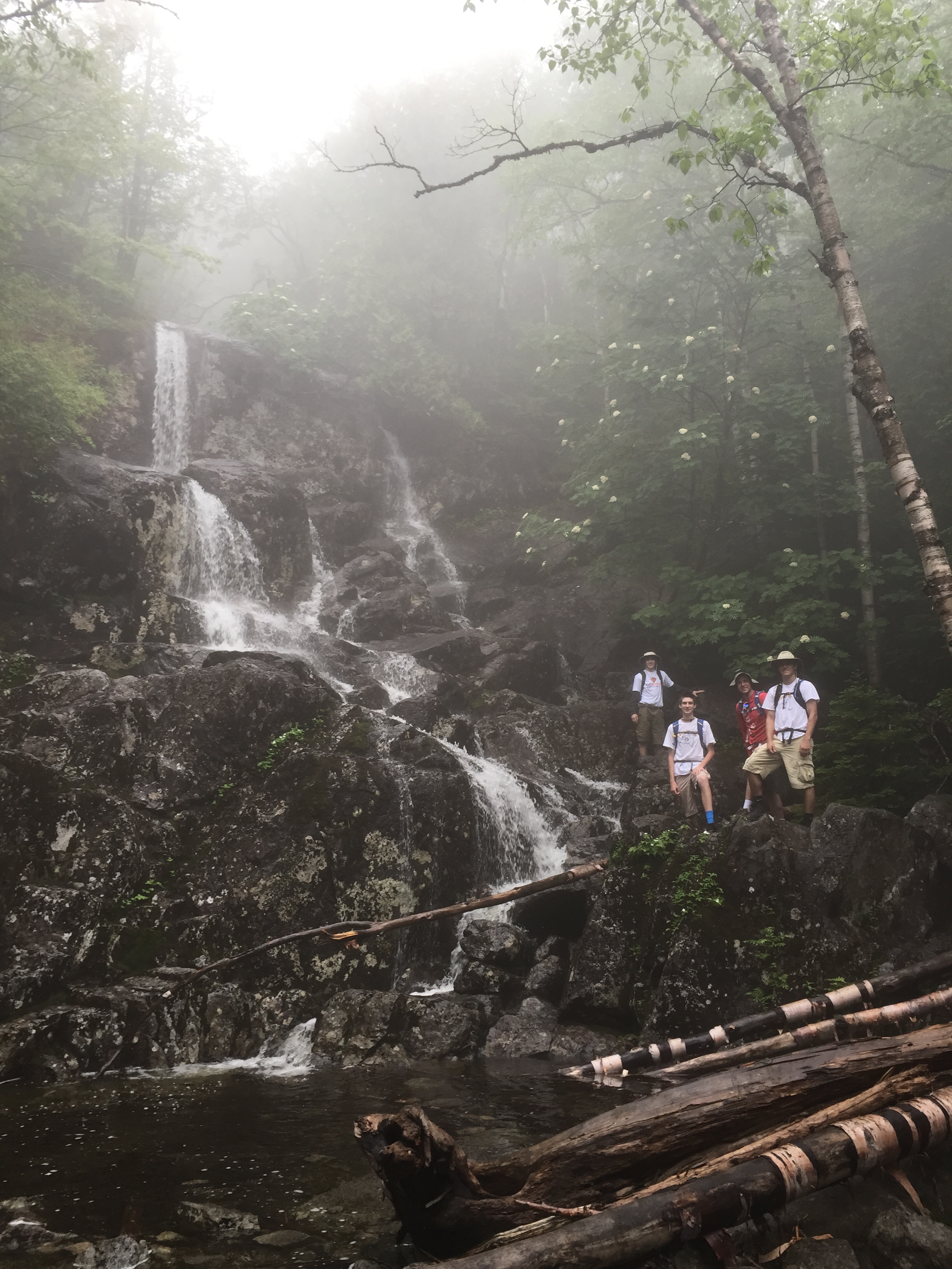
Our hopes for clearing weather never came to pass and we spent the day hiking in a constant drizzle and had to pour water from our boots after the last stream crossing. We finished the hike just before 6.

Alex and his friends Nate, Kyle and Collin were waiting for us at the house when we returned to Lake Placid.

FullSizeRender

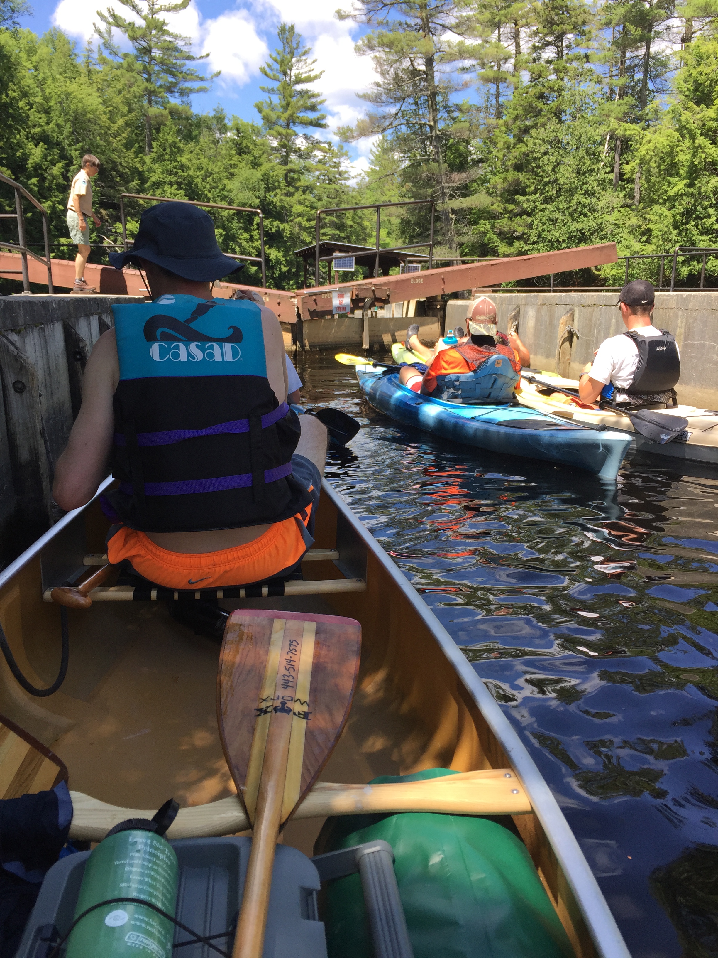
The next morning we kayaked and canoed to Middle Saranac Lake repeating a trip I had taken two years ago with friends and a trip my mother took regularly when she attended Saranac High School.


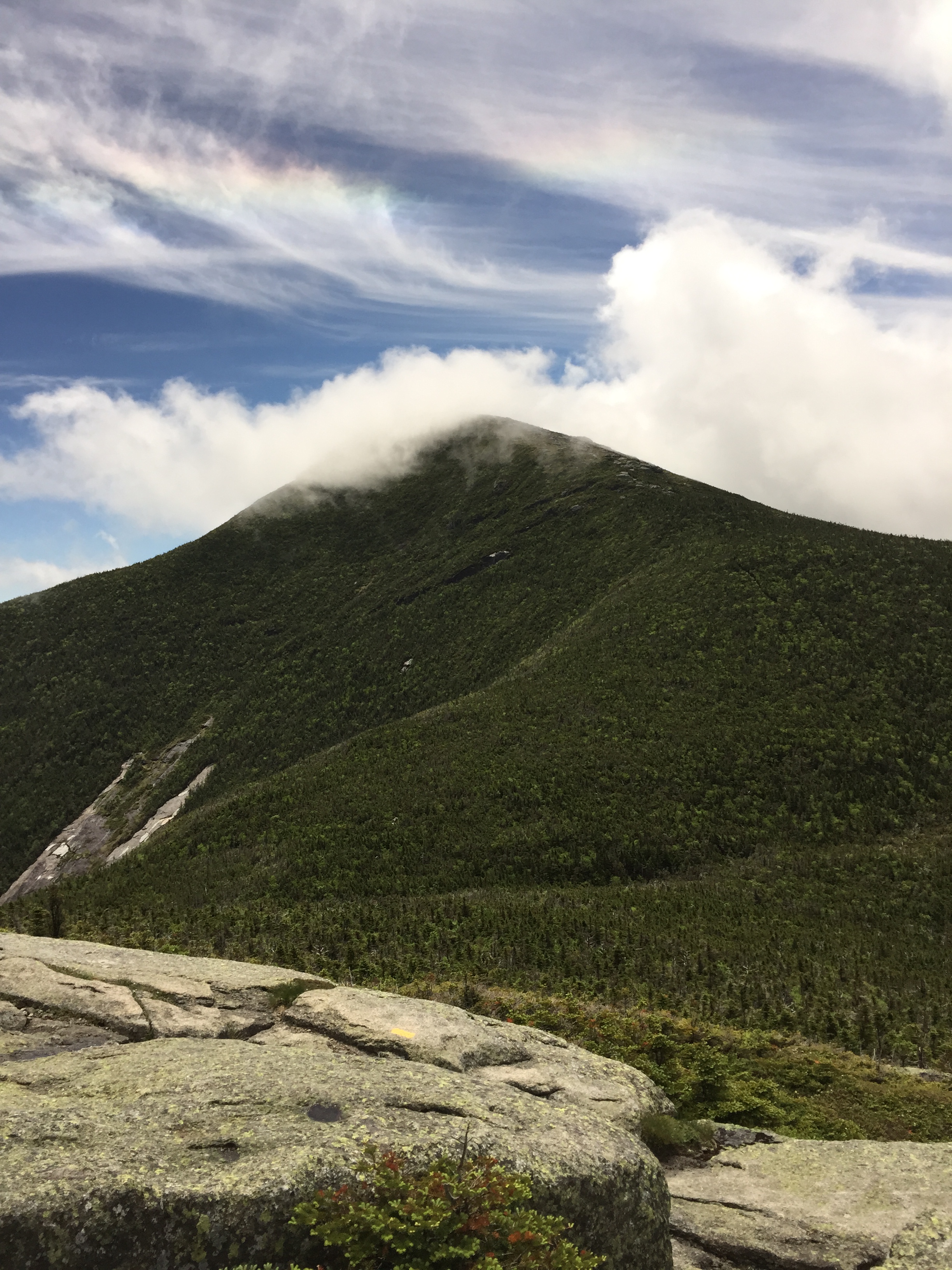
On Tuesday, the six of us returned to climb Seymour Mountain, named for yet another former New York governor. We left the trailhead at 8:00 and reached the herd path to Seymour Mountain at 10:30.

FullSizeRender 2

The weather was sunny and not too humid but the trail was still muddy from the rain earlier in the week. The climb was challenging with lots of steep rock scampers along the way. We reached to summit at about 1:00 PM and ate a quick lunch before heading down.

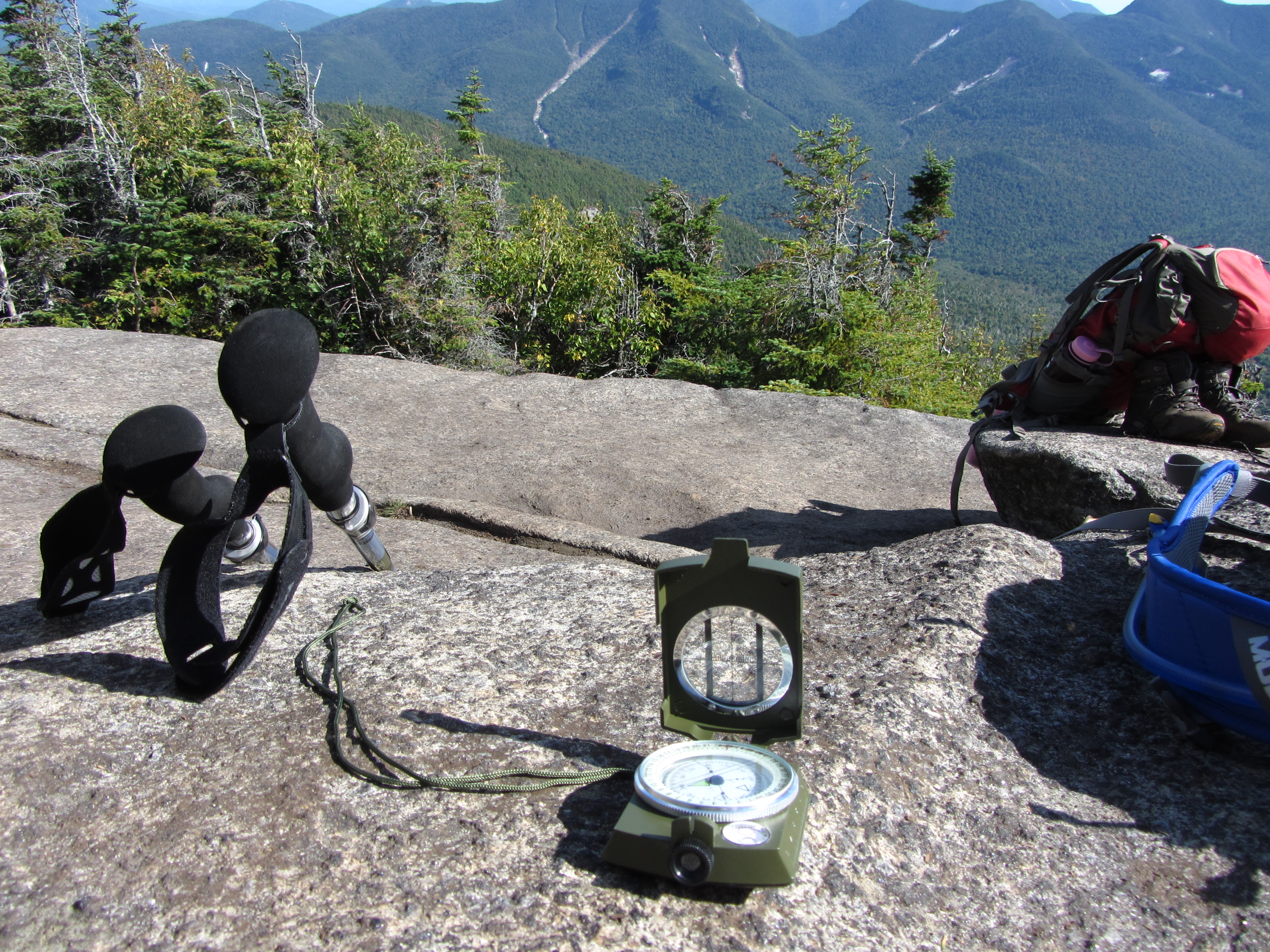
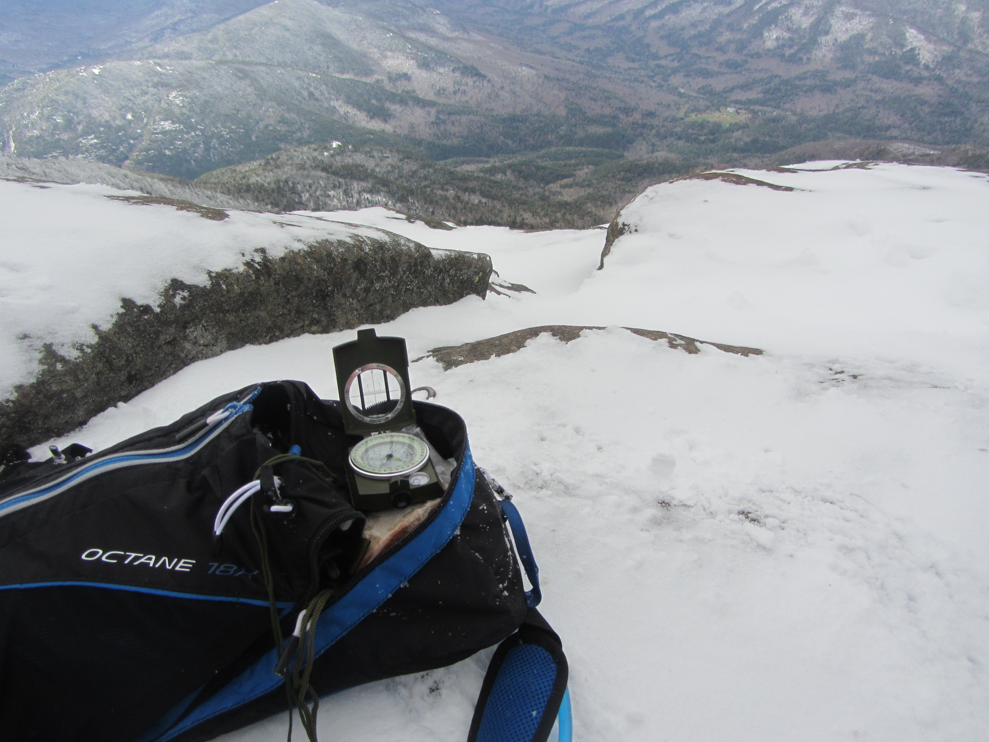
During the hike I taught them some of the lessons I learned from Oscar and Hannah last fall, like how to orient a map and use a compass and how to make water from the streams safe to drink.

My companions are strong athletes and team players. They offer a hand to help with steep climbs and they guard each other against falls during the descent through steep and wet terrain. They share their water and food and work together to find the solution when I stop along the route to challenge them to “Tell me precisely where we are on this map.”

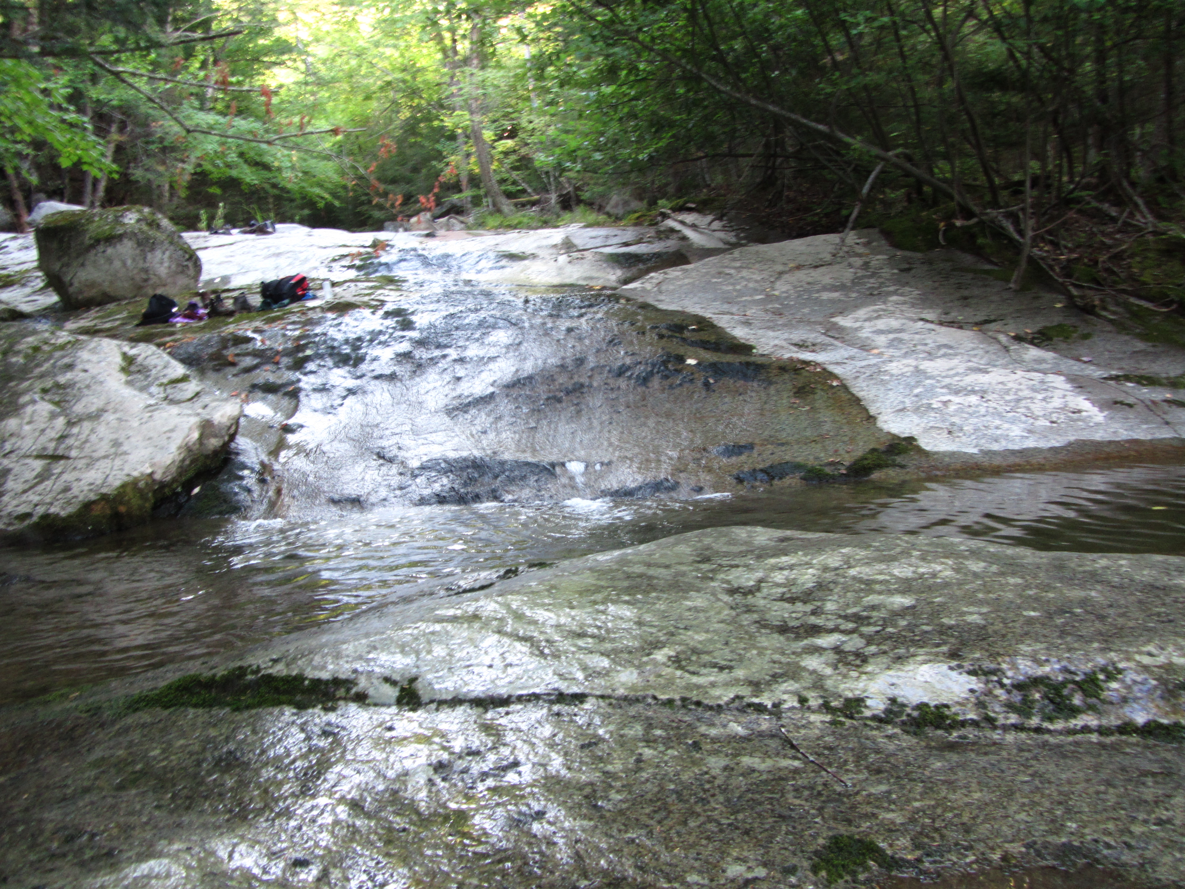
The climb down from the summit took nearly as long as the climb up and we were already very tired when we rejoined the Ward Brook trail to start the four mile hike back to the trailhead. I kept to my regular pace but they were anxious to be off the trail and away from the mosquitos that joined us as we passed by Blueberry Pond. I am not concerned. They have proven that they can find themselves in these woods and work together to solve problems and take care of each other.

I let them go and finish this journey in solitude.

11994329_10205847054188154_925783774_n-2

Kathy, Abby and I started coming to the Adirondacks in 1997. Abby took her first sailboat and paddle boat rides on Upper Saranac Lake and learned how to paddle a canoe there as well, a skill that came in handy that time I rented a power boat and ran out of gas two miles from the marina.

We came almost every summer and always spent a part of our vacation hiking. I bought every book I could find about the trails in the Adirondacks and tried to pick out hikes suitable for Abby as she grew from a toddler into a teenager. One of the first hikes we took together was to Rocky Falls. Here’s the description of the hike in Guide To Adirondack Trails:

Rocky Falls—4.8 mile round trip. An easy walk along the start of the Indian Pass Trail to an attractive little series of waterfalls and large pool for swimming.

The weather was a bit iffy when we started our hike to the falls but we brought rain jackets just in case there was a brief shower. We followed the trail but it had been a dry summer and when we reached the brook there didn’t seem to be anything that looked like a waterfall or a pool large enough for swimming.

We turned back, not sure whether we’d actually found the falls and then it started to rain. Hard. The next two miles were miserable and the rain soon overpowered our jackets and soaked us to the skin.

To get us through it we played a game that Abby had invented. It was basically a variation of “20 Questions” with the goal to try to guess a character from the Harry Potter books. Abby was amazing at the game. I could never stump her when it was my turn to pick a character. When Abby picked, Kathy and I would often ask dozen of questions before giving up to learn of some minor wizard that was briefly mentioned in the middle of The Prisoner of Azkaban. It was a fun game and it came in handy to help pass the time on our family hikes.

Today, I decided to return to Rocky Falls on my way to Mount Marshall. I left the Adirondack Loj parking lot at 6:25 AM and reached the falls at 7:17. There was plenty of water and what I saw today matched exactly the description I first read eighteen years ago.

11997864_10205847054228155_1056491633_n

The remainder of the hike to Mount Marshall was hard. Most hikers approach it from the camp sites to the southeast of the mountain. I took the longer route and approached from the northwest first climbing to Cold Brook Pass before taking the shorter but much steeper unmarked path to Marshall.

By the time I reached the summit at 11:27, the temperature had risen to 80 degrees and it was very humid. I was a bit dehydrated from the climb and regretted not stopping on the way up to top off my water bottles. It was a long, hot trip back to the parking lot but I finished the 17 miles in just under ten hours.

11998414_10205847054148153_289603714_n

There wasn’t a cloud in the sky and no need to rely on The Harry Potter Guessing Game to get me through the last few miles. I played it anyways, making a list of the characters to use on my next hike with Kathy and Abby.

2015-08-11 09.24.40

My hike to Table Top and Phelps starts later than usual and I don’t depart from the Adirondack Loj trailhead until 8:49 AM. I cross below Marcy Dam at 9:38 and follow the blue trail as it climbs along Phelps Brook before veering south towards Mount Marcy. My plan today is to hike to Table Top Mountain and then climb Phelps Mountain on the way back to the trailhead.

2015-08-10 09.37.20

Marcy Dam

It is hot and humid and I stop at the second to last crossing of the brook to refill my water bottles. A father and a son pass by me as I sit on a rock waiting for the Steri Pen to finish. We exchange hellos and they continue up the blue trail. The boy is a chatter box and appears to be about ten years old. His father is quiet. They are well prepared for the hike carrying day packs and wearing well-worn ankle high boots. I wait a while longer to give them space before rejoining the trail.

I pass the start of the trail to Phelps at 10:15, reach the start of the trail to Table Top at 10:57 and begin the steady climb to the summit. As the trail steepens I narrow the gap and can now hear bits of their conversation. The boy wants to know how much farther is left to climb. The father does not answer at first, perhaps realizing that with lots of climbing yet to do no prediction will satisfy the boy. When pressed, he finally replies, “I don’t know, but we sure have hiked a long way.”

I hear this exchange several more times as they continue the climb and think that there is no better answer to the boy’s question. When I reach the summit they are having lunch on a rock ledge. The father identifies by name the peaks that are spread out before them and the son asks about the trails to each and the father shares his memories from having climbed them in year’s past. After they leave I finish my sandwich as a storm gathers around Mount Marcy.

2015-08-10 14.27.38

Mount Marcy from Table Top

I start the climb to the Phelps summit at 1:25 PM. This trail is much harder than the trail to Table Top and I have to stop several times to catch my breath. I climb a section assuming that I have reached the top only to find that the trail heads in another direction and starts climbing again.

I get discouraged and want to check the map to figure out just how much more is left to climb. Instead I remember the father’s answer to his son and choose not to worry about what lies ahead but rather to be proud of what I have accomplished thus far.

2015-08-10 14.52.17

Wright and Algonquin from Phelps

Goodbye Grace.

July 26, 2015 — 2 Comments

2015-07-24 12.40.37

The planned hike was an ambitious one. Meet for coffee at 7:00, reach the trailhead by 7:30, follow an unmarked trail to the start of the Dix Mountain Range and hike to four of the high peaks before returning to Round Pond. The hike would cover nearly sixteen miles, the first seven of which were along unmarked paths to the first peak.

Her name is Grace and it fits her perfectly. She is simple, elegant and set apart from the other four in the range. She is hard to reach because the path is not that obvious and the several crossings of the South Fork of the Boquet River are hard to find. When you get closer to her the trail improves but then gets very steep.

The view from the summit is breathtaking and we sit silently eating sandwiches and surveying the three remaining peaks we had hoped to reach. They are too far away and separated by valleys that are much deeper than we expect. It has taken too long to get here and there is not enough time left to complete this journey. We decide to head back the way we came and to leave the remaining three for another day.

It is beautiful here and I really do not want to leave. I try to convince myself that I will visit Grace again, but I know it will likely not happen. She stands alone, away from the others and no longer on the way to anything else on my list. I regret this deeply because I have loved this hike more than any of the others I have taken.

2015-07-26 08.58.45

2015-06-19 13.27.46

My nephew Tommy lives in the house where my father died. He sleeps in the room I shared with his father before I moved a bed and some other furniture to the shed next to the garage. In a week he will graduate from Sidney Senior High School, thirty-seven years after I received my diploma from the same school.

This weekend Tommy brought three of his friends to Lake Placid to celebrate their graduation and to hike with me to Algonquin Peak and Wright Peak.

2015-06-18 22.37.58

We arrived at the trailhead before 8:00 AM and took our first rest break as we crossed below the waterfall on MacIntyre Creek. We hiked quickly and were the first group to make it to the summit of Algonquin today.

2015-06-19 08.59.32

The summit was encased in fog and the wind was strong and very cold. We finished our lunches quickly and headed back down to pick up the trail to Wright Peak. It was still foggy when we reached the top but we stayed long enough to watch the fog finally lift, revealing a magnificent view of the peak we had just climbed.

2015-06-19 13.40.18The trails were wet and slippery during the descent and before long Tommy, Brandon, Kyle and Nick pulled away from me.

As I walked down the trail by myself it occurred to me that the town where we all grew up has changed drastically since the day I received my diploma. The factory that first made Magnetos for the Army Air Corps during World War Two and later important components used in the Apollo lunar missions is nothing like it was in the 70s, having lost most of its manufacturing jobs when they were moved to Jacksonville, Florida. The movie theatre in the center of downtown closed years ago and the roller rink recently burned to the ground. The village’s oldest houses along River and Bridge streets were devastated by back to back floods and may need to be torn down. The football team used to have to play all of its games on the road because the field didn’t drain right. Even the traffic signal on Main Street has stopped working.

And yet somehow despite all this my home town has survived and still remains a great place to make friends who will last a lifetime. And for Tommy, Brandon, Nick and Kyle that is more than enough.

2015-06-19 12.55.40

Giant love

November 9, 2014 — 1 Comment

Today I climbed Giant Mountain. At 4627 feet it is the twelfth highest of the forty-six high peaks. I take the Roaring Brook Trail approach which is 3.6 miles to the summit with an ascent of 3375 feet.

2014-11-08 16.22.41

It is just below freezing when I start and I wear the winter hiking clothes I bought yesterday. My hiking shoes are heavier today with spikes attached.

2014-11-09 14.01.01


The trees are bare and the lower part of the trail is covered with frosty dead leaves. The rocks that just weeks ago were coated with wet moss are now encased in ice that the spikes grip easily.

I make a quick detour to visit the Roaring Brook Falls before rejoining the trail to the summit.

2014-11-09 09.26.26

It starts to snow and soon the trail is covered with a light dusting that tells me that no one else has passed this way this morning. I pause occasionally to take pictures and make steady progress up the trail.

2014-11-09 11.52.59

I do not see another person until I am nearly to the top when I step aside to let a young couple come down a rock face from above. They are returning from having spent the night at the lean-to on the far side of the mountain with gear they rented for the weekend. They do not have spikes on their boots and it is too slippery for them to walk on this part of the trail. Instead, they sit and slide down the rock together, smiling and laughing the whole way down.

I have the summit to myself. It is beautiful but cold so I do not stay long. On the way down I pause at the rock with the side by side slide marks and smile remembering how two people, clearly in love with each other, spent a few wonderful moments together in a wonderful place.

2014-11-09 11.54.34

2014-08-30 17.34.32

The two of us left Baltimore early Friday and had just crossed into Pennsylvania when my phone alerted with a text message. A quick stop was followed by a quick phone call and a quick change of plans. We circled back and after a short stop for coffee the three of us were back on our way to the Baseball Hall of Fame and then on to Lake Placid.

The next morning we started the hike a bit later than planned. The parking lot at The Garden trailhead was full so we parked at Marcy Field, five miles away, and took the local bus to our starting point. The driver stressed that the last bus back would leave at 7:00 PM, “sharp ’cause I’m not waiting.”

We signed the trail register and started our hike to Big Slide by way of The Brothers. We would hike nearly ten miles before the day was finished, ascending 2800 feet to the summit of Big Slide, which at 4,290 feet is 27th in the order of height of the 46 high peaks I hope to climb over the next four years.

2014-08-31 08.05.09

The weather was perfect and everything we saw was beautiful. We stopped two hundred yards from the trailhead to watch a young deer as she slowly crossed the trail in front of us. We paused at every overlook, sometimes to enjoy a sandwich, others to share cheese and apples, and still others just for quiet contemplation. We taught her how to use a compass and how to orient a map. She picked most of the routes up the rocks and we followed.

2014-08-30 13.40.28

We met interesting people along the trails and at the overlooks. A couple from Montreal was just finishing a hot lunch and shared stories of their other hikes together. As we approached the summit, we paused to let a family pass us by, the pre-teen boys descending with abandon and using saplings to break their falls and slow their descents. Their sisters were a little older, but just as courageous. At the summit it seemed that everyone there had some connection or another to Indiana.

We finished the food we brought, took some pictures and headed back by way of a trail along Slide Mountain Brook which we crisscrossed several times hopping from rock to rock to keep dry.

With four miles left we heard the same laughter and shouting we had heard earlier and knew we were coming upon the boys and girls we had watched scamper down from the summit a few hours before. They had found a natural water slide and were taking turns gliding along its moss-covered rocks into the pool of very cold water at its bottom. We were tired and very short on time but stopped anyway. We emptied our pockets, placed our packs in a dry place and for fifteen minutes became young again.

We hustled back to the trailhead and made it in time for the last shuttle bus. We had spent the day to the fullest, not compelled to rush away from the beauty we were experiencing and had even played in a water slide and still made it back in time.

Which goes to show that sometimes you just need to forget about the schedule, take time to enjoy beauty and turn around for a friend.

2014-08-30 15.38.59

Alone in the woods

August 17, 2014 — 2 Comments

2014-08-17 11.27.49

It’s 56° and there’s a light rain as I drive from Lake Placid into the Keene Valley to begin today’s hike to Porter and Cascade Mountains, two of the forty-six high peaks I hope to summit in the next four years. The conditions are not great but if I’m going to complete this journey in time for the 100th Anniversary of the founding of the 46ers I’m going to need to hike in all conditions.

I have probably over-packed for today’s hike, a vestige from my Boy Scout days. I am carrying three liters of water in a Camelback, the pockets of which I have stuffed with a space blanket, emergency sleeping bag, signaling mirror, first aid kit, map, guidebook, flint and a survival knife. I am also carrying two sandwiches, some fruit and the compass pictured above.

I start at 7:20 AM from the Marcy Field parking area and climb first to Blueberry Mountain and then on to Porter and Cascade before returning to the parking lot. I am alone today and will hike for thirteen miles, not seeing another person for eleven of those miles.

The trail to Blueberry Mountain is very steep at the beginning but the mountaintop offers wonderful views of the fog lifting from the valley below. The trail is well-marked with yellow trail markers and stone cairns placed strategically across the rock outcroppings where there are no trees.

2014-08-17 09.19.52

While following the line of cairns atop Blueberry Mountain I came upon some stones made into the shape of a heart. The moss growing on the stones tells me they have been here for sometime. As I head on to Porter I wonder about the story behind the heart on top of the mountain and begin thinking about a backpacking trip I took in the Adirondacks with John and Jerry in the late fall of our senior year of high school.

At the time I had a terrible crush on a girl in our class. We’d become friends that summer and spent a wonderful day taking her younger sister on all the amusement rides at that year’s State Fair just before school began. I never mustered the courage to tell her how I felt about her and our relationship never went any further. Just before leaving for the trip I learned that she was going steady with the captain of the basketball team.

I was heartbroken and not very good company to John and Jerry. With John, though, a bad mood never lasts long. While he had no great words of wisdom he just knew how to make you feel better and when we walked out from the woods three days later I was ready to move on from the heartbreak.

Jerry died of cancer at age 41 and I remember how devastated his son JT was at the funeral. Later that spring John organized the first of many annual trips to South Carolina to take JT golfing and visit with Jerry’s parents. Over the years I watched JT grow into the amazing person he is today and marveled again at how John knew how to say and do just the right things to help JT deal with the tragic loss of his father.

As I finish today’s hike I realize that I have never known a more dedicated and caring friend than John. So while I’ll never learn the true story behind the heart made out of stones I came upon in the Adirondacks today, I will choose to remember it as a symbol of the love shown by John to a friend who left us too soon.

2014-08-17 09.18.12

The-Spirit-of-the-Park

This picture appears at page 346 of Thomas Morris Longstreth’s The Adirondacks, published in 1917. In that book, Longstreth describes the Adirondack Park as follows:

We have our little air holes in the cities, which we call parks, and we have some sections of the West roped off by law which the East is welcome to roam over if it can pay the carfare to them. But it has remained for New York State to set aside more than a tithe of its total area where men and women can seek sanctuary from cities and heat and the everlasting press of things. And New York State has done more. She has not only offered her mountains and lakes and woods to the tired student from Ithaca, the tired philosopher from the Hub, the tired businessman from everywhere, but she has made trails through the mountains, has stocked the streams and lakes, and is doing her best to preserve the forest. The citizens of the State pay for this, and anybody can enjoy their gift for a thank-you.

Perhaps inspired by these words, brothers Robert and George Marshall along with their friend and guide, Herbert Clark, climbed Whiteface Mountain on August 1, 1918. Nearly seven years later, on June 10, 1925, the three finished climbing the 46 high peaks of the Adirondacks and became the first three members of “The Adirondack Forty-Sixers.”

Since then 8,283 hikers have joined Herbert Clark and the Marshall brothers to become an “ADK 46-R.” If all goes well, later this month I will start my own journey to add my name to that list. I will start the first hike sometime after 12:01 AM on July 28, 2014, but will save Whiteface Mountain until last and climb it on the 100th anniversary of the hike that started it all.

So, if you have a few days to spare over the next four years, pick a peak that interests you and come hike with me awhile.

photo